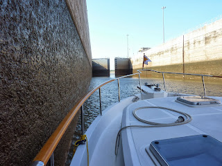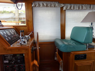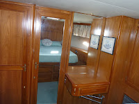
This was our view from the back of our boat while docked at the Alton Marina.
Saturday, September 28
Dream Chaser and Sanctuary, a 43 ft Tiara, departed the Alton Marina about 8 a.m. and with cloudy skies and a brisk wind, passed through the massive Mel Price Lock and Dam without incident.
Exiting the lock, we continued on the 44 mile trip to Hoppies Marine Service to overnight. At Mile Marker 195, the Missouri River joined the Mississippi creating heavy turbulence and strong eddies which caused the boat to shift around considerably.
We navigated the Chain of Rocks Canal and the Chain of Rocks Lock and Dam which is the last of the two locks we encountered on the Mississippi River. On leaving the lock, the turbulence in the river increased dramatically. This is the view from where Mary stands in the boat.
As we motored towards St. Louis through the Chain of Rocks Canal, numerous towboats with barges in tow were stopped or banked along the canal. We discovered that a 48 hour dredging operation was underway in the St.Louis Harbor which closed the area to barges and tows, thus stopping northbound and southbound commercial traffic. This was a wonderful break for us because instead of dodging massive amounts of river traffic, we motored on through and had time to enjoy and photograph the arch!
St. Louis was a fascinating sight off to our right- the arch rising into the sky, with paddle boats docked below along the river. There is no docking in St. Louis for pleasure craft (unfortunately), but we had already visited the area five years ago, so, no problem.
Our two day delay in Alton was due to a barge grounding (which broke the holding straps apart) in this St.Louis area. Being delayed turned out to be a good thing because we met the boaters in Sanctuary, Go, and Five O’ Clock and will be traveling with them over the next few days as we motor down this challenging long stretch of river.
Yes, just in front of this tow is a person paddling a kayak in the turbulent Mississippi River with 3 mph currents and 15 mph oncoming winds! Adventurous or crazy?
Mary reflects:
As I kicked back in my new admiral’s chair in the top helm, I thought back to our dinner with our Sanctuary friends, Jim and Meg, last night at Fast Eddie’s. This establishment should be on the historic list of landmarks or featured on Diner’s, Drive-ins, and Dives from all the hype we’ve heard. When we arrived at Fast Eddie’s in our Comfort Cab (that’s a story in itself), the building is nondescript outside, but inside your attention is focused on the funky splashes of bright neon lights. Things were hopping with patrons of every age, lifestyle, and economic level- business people, travelers, locals, bikers, colored hair, no hair, and lots of tattoos! We waited in line to order food and people consumed drinks until they made their way to the front of the line. Gives you an idea of how they make a profit! The menu sign behind the service counter above the working grill listed brats, burgers, and fries for about a buck. Steak and chicken on a stick are $2.99. What a deal! Steve and Jim were thrilled! Dinner for less than $20 (including the cab ride)! You order your food, get an order number, and hunt up a table. No seats available inside? No problem! Fast Eddie bought the adjacent street, built a wall around it, added a tin canopy, set up tables and chairs, and thus created a smoking section to beat the no smoking ban! The action is back here with dancing, drinking, and whatever. Not much ambiance but it’s a gold mine! I wish I had pictures!
About 23 miles downstream from St. Louis is...Hoppies!
A strong wind from downriver was blowing steadily when we docked at Hoppies. Fern and her daughter were waiting at the dock and carefully tied us to the outside of the dock adding spring lines in case it stormed as predicted. The space inside the dock was filled with small cruisers and runabouts. All the descriptions of Hoppies were accurate, from the description of the docking area to the strong lady herself.
Hoppies Marine Service is a unique experience and famous stop on a wide spot in the river where you can get gas, grub, and great advice. Owned by Charles and Fern Hopkins for the last 40 years, Hoppies is the last marine fuel stop for 228 miles. After Hoppie fell from a ladder ten years ago and sustained injuries, Fern and her daughter have been in charge of the marine service. The little town of Kimmswick is within walking distance, and the grocery store is about 2 miles away. The marine service consists of three 100 ft. barges lashed together and secured to a high stone cliff with cables. The barges have outlived their working life as some are 65 years old. When the barges leak, Fern plugs the holes with asphalt shingles until the holes can be welded. There is a sign by the fuel pumps on the barge that says NO SMOKING, but this has little impact as Fern and her daughter light up their next cigarettes. Electrical lines are strung along the walking areas of the barge, various weathered tables and chairs are scattered along the barges, and old rugs are scattered here and there covering electrical cords, etc. Things are done differently here! Steve loves it already!
The 20x20 ft. roofed, open air seating area is the “lounge” and Hoppie’s office. We are VERY happy to have a spot to dock since dockage is limited, and you must have reservations or you are probably out of luck. Fern is the local expert on the Mississippi River, and we were anxious to attend the briefing session regarding what to expect over the long stretch of the Mississippi River southbound such as river conditions and status of anchorages.
We returned in time for our briefing around 4:30 pm. Fern was delightful and gave a very instructional talk on the miles of the Mississippi River that lie ahead. Whether they admitted it or not, everyone in our group of loopers appeared a little anxious about the next 228 miles with no services and no dockage. We all took very detailed notes as Fern related what lay ahead southbound on the Mississippi River. Meg, from Sanctuary, invited Fern to join them on their boat for the next 228 miles luring her with good cooking, delicacies, etc. Fern just chuckled at the offer.
At the top of the river bank above our dockage, Fern, Hoppie, and some local boaters were gathered around a campfire as 70‘s music played from a boom box. As we approached, music from ZZ Top was filling the air, a man near the fire joined in with a guitar, and the picnic table was loaded with food. Supper was a potluck of soup, brats with sauerkraut, and other great smelling dishes. We joined the circle around the camp fire and had pleasant conversations about family, weather, fishing, floods, and where we were headed, as marshmallows were roasted and chocolate cake was enjoyed.
As a result of our conversations, we discovered that cicadas were the cause of all the noise in the woods around us. This Spring’s flooding, caused a 32 ft rise in the Mississippi which in spite of the high banks caused flooding all around Fern’s house. The flood of 1993, caused a 42 ft rise in the river, and the flood line was up to the roofs of the large metal storage buildings near her house. In anticipation of this flood, they removed virtually everything from the houses and buildings that they could including carpet. This is life along the river!
In anticipation of our day ahead, we chose an early bedtime and were rocked to sleep by waves from passing barges.
Sunday, September 29
We dropped boat lines at 7 am, headed at a 90’ angle from Hoppies dock, and redirected Dream Chaser southbound. Our AGLCA looper friends in Sanctuary, Go, and Five O’clock will be following later in our wake. Weather is very cloudy and cool today. We had expected a bit of a storm last night, but only heard light rain at 1 am and 3 am. The cool air is a relief from yesterday’s 80’s and high humidity. About three hours into our days journey we had light rain for about 2 hours. We used the lower helm for a short time, but due to increased barge traffic, decided we needed the better viewing from the upper helm. It was a perfect day for a good book and a warm blanket-if you weren’t steering the boat, navigating, and doing all those necessary boat things.
The Mississippi River continued to move at 3 mph and was quite wide at this point.
We are still seeing large beautiful homes along the bluffs overlooking the river probably because St. Louis is only about 50 miles away. There are lots of rock weirs jutting into the river all along the way. They are about 1,000 ft apart and stick out about 200 ft perpendicular to the river bank. Big sandy banks ease into the river 10 ft to 1/2 mile deep on inside curves of the river. Strong eddies, swirling pools of water, are formed from deep holes in the river.
As we motor southbound, the river is tree-lined with bridges, electric plants, a cement supplier, old boat ramps, a structure like a castle, a few people fishing, some questionable old structures, and big sandbars jutting out along the banks. At this point in the river, Mary won’t let Steve stop along the way to pick up or help strangers, as we are passing the Chester Penitentiary (max security). The funniest site was a local ferry that consisted of a very little tug and a small barge with sides. The car was parked in the middle of the barge and the tug, not tied to the barge, merely nudged the free barge on it’s sides to the other side of the river to a cement road that led up the river bank.
At mm 130 and mm 84, we checked very carefully for any northbound tows as we were told not to enter either curve in the river with a tow and barge using it or we would be the loser! All clear!
The dredging in St Louis Harbor has been great for us! We have motored right down the river with several tows and barges, but the numbers would be multiplied had that part of the river been open. We have seen numerous barges banked or “sleeping” along the river since we left St. Louis. We will be past some of those heavy traffic areas before the dredging ends and the harbor reopens.
Do you remember the adventurous or crazy person in the red kayak that I mentioned seeing paddling southbound in the river by St. Louis? Well, we passed a pitched tent and a red kayak on the river bank about 11:30 this morning. Could it be?
There are moments of “What the ----?” like when Mary looked out the window from the galley and saw the green channel marker to the right near the bank, a red channel marker to the left about mid channel, and another green buoy near the left bank! To stay in the boating channel, you motor between the red and green channel markers. So, which ones do we choose? This is where autopilot comes in handy to double check where the channel actually is. With steady Steve behind the wheel, we were fine!
Anchored out for our first time, we followed Fern’s advice and ended up at about mile marker 78, behind an L dam in water up to 50 ft deep! The first time we tried to set the anchor, it didn’t catch and we drifted, but the second time Mary dropped the anchor, it worked like a charm! We have two anchor alarms to warn us if the anchor would slip or move. One is called Drag Queen, a free app, which works off the GPS satellites. We place our I-phone next to our bed, but phone service isn’t necessary. By the way, we had dinner in Alton with the author of Drag Queen and the founder of Active Captain. Active Captain is a site that keeps boat enthusiasts aware of any shoaling, best overnight anchorages, best price fuel options, and has a membership of over 200,000 boaters. The second alarm is on our Garmin boat navigation system. No warning, no problem!
Steve enticed our Sanctuary captain, Jim, to accompany him on an excursion in our dinghy. Even though the dinghy was under inflated, they hopped in and crossed the Mississippi to a beautiful sand beach and walked. After about an hour, they returned smiling like Tom Sawyer and Huck Finn after a successful adventure.
We watched the sun set as we grilled supper and had a piece of “mile high” apple pie from the famous restaurant in Kimmswick. Life doesn’t get any better than this!
Monday, September 30
At 7 am, Mary pulled the anchor, and Dream Chaser motored into the Mississippi River channel into a light fog with visibility of about one mile. Last night, our anchorage had been off the channel far enough to be protected from waves created by the numerous barges that passed through the night. Fog continued to hang in the river valley, cows grazed on the hillside to our starboard side, limestone rock walls lined the shore, and we passed a stone quarry (one of many along the Mississippi) where barges were waiting patiently for their load. As anticipated, the St. Louis Harbor must have opened as barge traffic has increased dramatically with three tows and barges in the last 30 minutes!
We met this barge going upstream with a huge load!
Back in the early 1900-1930's, the Corps of Engineers built wood dikes to attempt to control water flow. These have now been covered by wing dams (rock walls).
By 2 pm, Dream Chaser was anchored off Angelo's Towhead, mm1, near Cairo, IL and the mouth of the Ohio River. We anchored off from the sandy point and will have some waves being just off the channel, but far enough off so barges wont be a concern through the night.
After a dinner of fish tacos, Steve and I jumped in the dinghy and motored over to where Sanctuary was anchored and joined them in a game of Rummikub. Dream Chaser is the boat to the left.


